
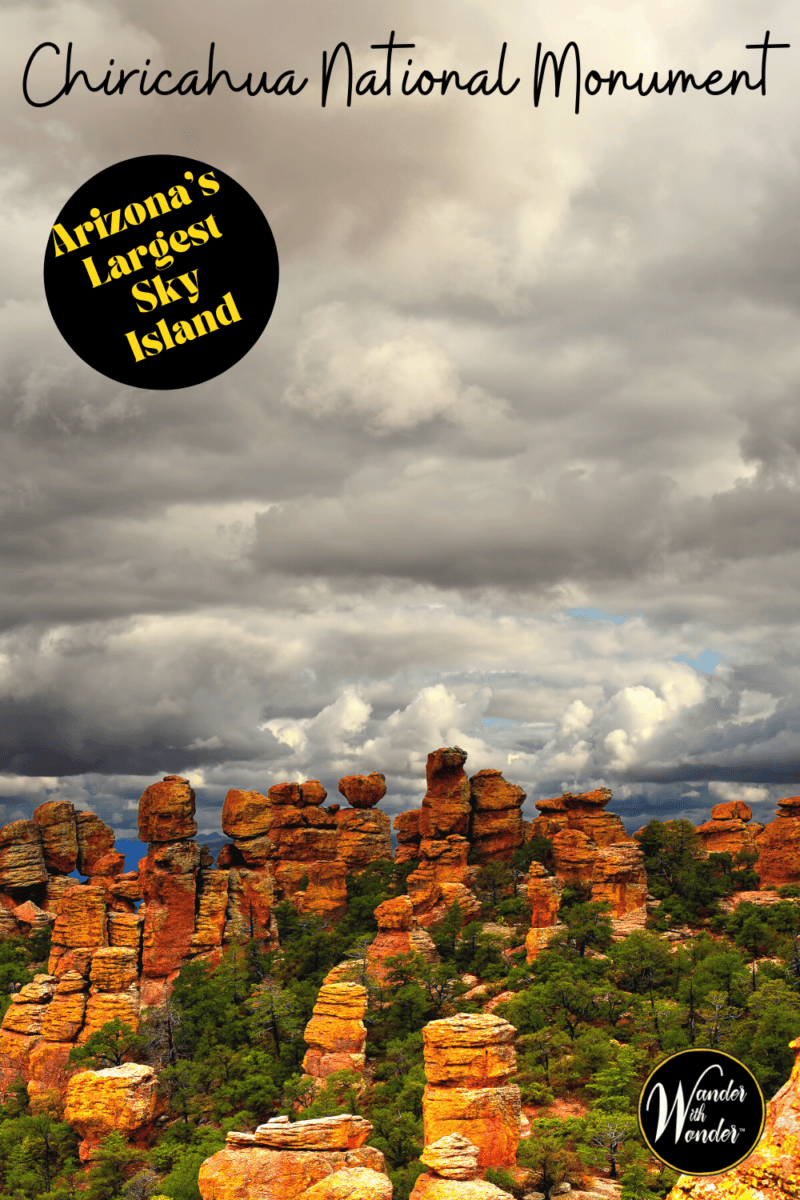
Table of Contents
Located on the southeastern corner of Arizona, the Chiricahua National Monument offers a perfect place to get out and explore, stretching your road-weary legs. Just south of well-traveled Interstate 10, the Chiricahua Mountains got their start with a volcanic eruption some 27 million years ago. Now considered a sky island, visitors can explore this national monument in a few hours and enjoy some cooler temperatures and a treed landscape, different from the surrounding grassland and desert beyond. Here are the top things to see in Chiricahua National Monument.
Note: A Sky Island is an isolated mountain range that juts unexpectedly from its surroundings. These are found in the area that covers Southern Arizona and Northern Mexico.
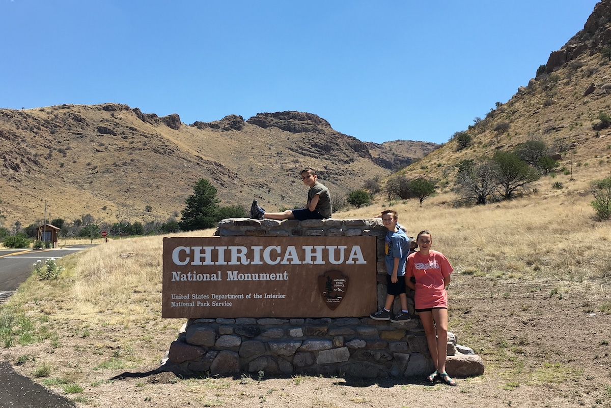
Stop at the Chiricahua National Monument for a quick pic. Photo by Catherine Parker
What Makes Chiricahua Unique
With a blast 27 million years ago, a volcanic eruption blew hot ash and lava into the sky, eventually settling nearly 2,000 feet deep on the ground. As it cooled the mixture fractured. Then time and weather whittled away at the mass and sculpted the elevated area into a maze of spires.
The Chiricahua Mountains are nearly 10,000 feet tall, so high they touch the clouds and grab the sparse raindrops of the desert southwest. With more rain than the surrounding desert lowlands, trees flourish in the Chiricahua Mountains. The area is called a sky island, or an area of higher elevation rock formations surrounded by grasslands.
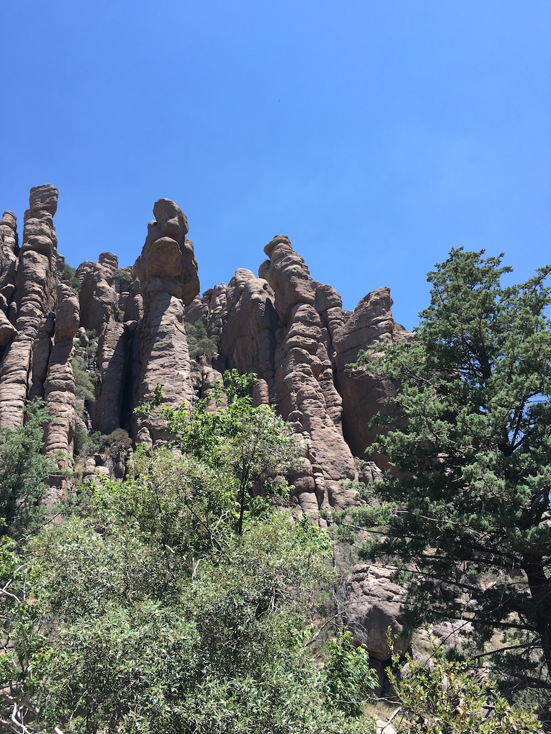
The rock spires of Chiricahua National Monument. Photo by Catherine Parker
Top Things to See in Chiricahua in 2 Hours
I stopped at Chiricahua during a road trip on my way to Southern California. During our visit, we explored the monument for a few hours and even did a bit of hiking. This was the perfect stop after a long drive.
- Stop by the Visitor Center
- Take the Bonita Canyon Drive
- Hike a trail, like the Massai Point Nature Trail
- Spot a coati, an animal native to the Chiricahua Mountains known for swiping people’s food.
- Smell the sweet smell of the firs and pines
Chiricahua Visitor Center
Built in the 1930s by the Civilian Conservation Corps, a Great Depression-era work program for young men in the U.S., the visitor center is a good place to start. The Chiricahua Visitor Center offers an interpretive area, maps, Junior Ranger booklets, a small bookstore, and a ranger-on-duty for questions. Additionally, a short film introduces visitors to the area along with its history.
Located on the west side of the monument on East Bonita Canyon Road, the center is open from 8:30 am to 4:30 pm.

A water bottle at the visitor center. Photo by Catherine Parker
Scenic Drives in Chiricahua
The easiest way to see a national park site is to drive through it. Bonita Canyon Drive starts at the western edge of the park boundary. As the 8-mile route passes the Visitor Center, it climbs gently through an oak and pine forest to Massai Point. From there, visitors can see Rhyolite Canyon. Since Bonita Canyon Drive is the main road in Chiricahua National Monument, it is used to access the Bonita Canyon Campground along with the majority of the trailheads. There is a vehicle length restriction beyond the campground due to the winding road.
Best Hiking Trails in Chiricahua
For visitors who hike during their visit, Chiricahua National Monument offers 17 miles of hiking trails. We hiked the Echo Canyon Grottoes during our visit and enjoyed the rock formations up close. Here are a few easy-rated hiking trails at Chiricahua.
- Silver Spur Meadow Trail—This 1.2-mile one-way trail begins near the Visitor Center. It passes the CCC-built fireplace, once used in a canvas mess hall tent, and continues past a bear cage built by the men of the CCC that once raised a bear cub. Finally, the trail passes the Stafford Cabin near Faraway Ranch. Pets are permitted on this trail.
- Bonita Creek Trail—A half-mile trail that connects Silver Spur Meadow Trail with the Bonita Creek Loop. Pets are permitted.
- Bonita Creek Loop—This short .2-mile loop goes around the picnic area, and pets are permitted.
- Massai Point Nature Trail—A half-mile hiking trail with interpretive signs.
- Echo Canyon Grottoes—This 1.0-mile round trip trail is a shorter version of the 3.3-mile Echo Canyon Loop.
Moderate hikes in the canyon include the Echo Canyon to the Visitor Center, a 4.2-mile hike. The Sugarloaf Mountain Trail is 1.8 miles one-way and climbs to the 7,310-foot mountaintop.

Grab your people and take a hike at Chiricahua, like Echo Canyon. Photo by Catherine Parker
Faraway Ranch in Chiricahua
On the western edge of Chiricahua, the Erickson family settled with three children in the late 1880s. The two daughters of the original Erickson family developed Faraway Ranch as a guest house in 1917. In addition to bringing tourism to the region, they named a rock formation “Wonderland of Rocks.”
In 1924 the area became the Chiricahua National Monument, and the Erickson family eventually sold Faraway Ranch to the National Park Service in the 1970s. Faraway Ranch is undergoing renovation, so tours are unavailable now.
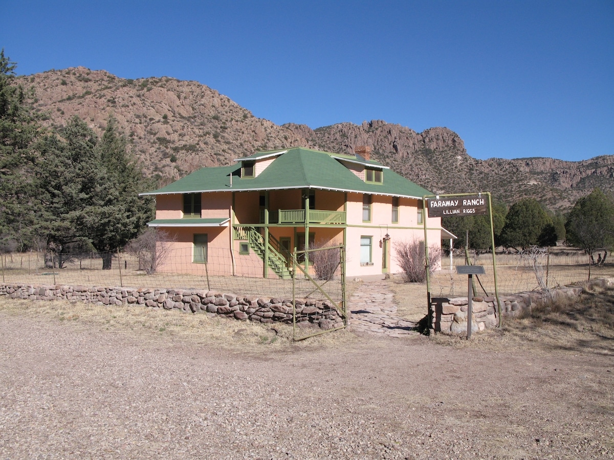
Chiricahua’s Faraway Ranch. Photo courtesy of NPS
Kids and Pets in Chiricahua
The Junior Ranger program guides families through the park. It’s free and takes about two hours to complete. My kids love the patches the Park Rangers present after completing their booklets. Head to a visitor center for more information.
BARK Program
Chiricahua National Monument welcomes pets as long as they practice the principles of the BARK program.
B–Bag waste and dispose of it in the trash
A–Always leash your dog for their safety and others
R–Respect wildlife
K–Know where you can go
Leashed dogs are welcome on the following trails: Silver Spur Trail, Faraway Ranch, Bonita Creek, and the connecting trail from the Visitor Center to the campground. Pets are allowed anywhere a vehicle can go, so turnouts and picnic areas are perfect for pets.
Horses in Chiricahua
Exploring a park site on horseback is a unique way to enjoy the area. Chiricahua is one of the National Park System (NPS) sites that allow stock animals inside its boundaries. Many of the trails in Chiricahua National Monument are open to horse use: Silver Spur Meadow Trail, Lower Rhyolite Canyon Trail, and Bonita Creek Trail.
Designated parking for horse trailers is near Faraway Ranch. The nearest equestrian camping area, Coronado National Forest, welcomes overnight camping with horses. For more information about visiting Chiricahua with horses, visit the NPS website.
Wildlife in Chiricahua
One of the top wow things to do in a National Park is to spot wildlife. Chiricahua, in southern Arizona, offers an array of animals not typically seen in lower elevations. Thanks to the trees and cooler temperatures, the following animals are often seen: coatimundi, Arizona white-tailed deer, Chiricahua fox squirrel, javelina, black-tailed rattlesnake, Mexican jay, and acorn woodpecker. There are four different types of skunks, and they all stink. Chiricahua is also home to poisonous coral snakes. Birders come to Chiricahua to spot hard-to-find Mexican species of birds. This is the northern limit of their range.
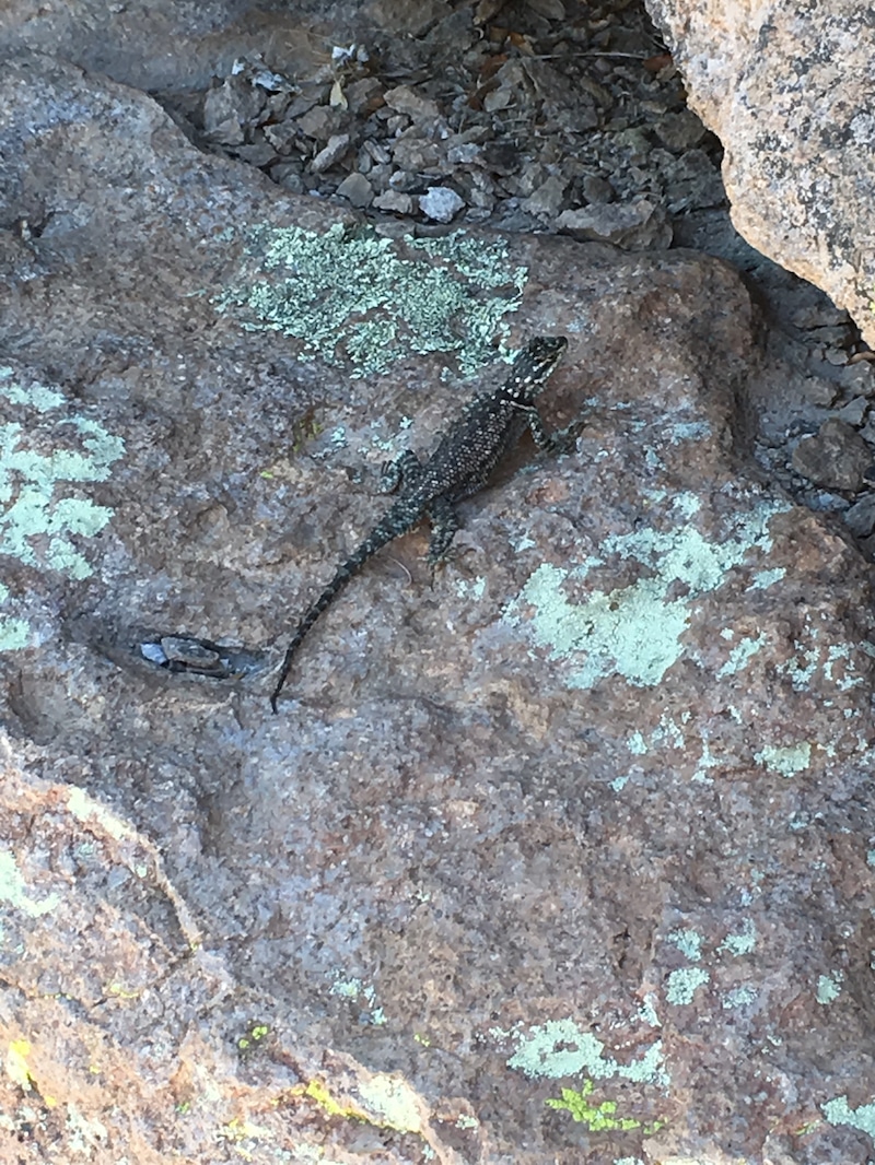
Wildlife spotting is a top activity in most National Park sites. Photo by Catherine Parker
Plants of Chiricahua
Known as a sky island, Chiricahua National Monument protects an area of higher elevation rock formations. Rising up to 9,763 feet from the surrounding grassland area, over 1200 different species of plants can be found in Chiricahua. From the parry agave to Schott’s yucca, the desert landscape transitions to a more treed landscape. Trees dot the rock formations at the higher elevations, and Arizona white oak and manzanita are found in the area along with pines and cypress.
The fall brings a variety of colors for visitors to enjoy. Fall and winter rains bring colorful spring wildflowers like the prickly poppy. Visitors can find more flowers later in the spring In the higher elevations of Chiricahua.
Night Sky Viewing
The night skies are nearly pristine in Chiricahua Mountains because they are isolated from large urban areas. Chiricahua National Monument was designated an International Dark Sky Park in 2021. Gazing up at the night sky with all the stars and even the Milky Way is a wow moment.
Dark Sky programming is offered during the year, or the sky can be enjoyed without a guide. The Faraway Ranch area offers the best-unobstructed views, and all pertinent information is at the visitor center.

Chiricahua Night Sky Photo. Photo courtesy of NPS
The History of Chiricahua
In 1924 Chiricahua National Monument was created to protect the unique pinnacles and balanced rocks in the Chiricahua Mountains. Known as a sky island, or an isolated mountain rising up from a lowland area, the Chiricahua Mountains are the largest area in Arizona.
The Chiricahua National Monument encompasses over 12,000 acres with 90% of the area designated as wilderness. Named by the Chiricahua Apache, they were referred to it as the “standing up rocks.” An eruption from nearby Turkey Creek Volcano created rhyolite some 27 million years ago, and the elements are still sculpting the rock formations today.
The People of Chiricahua
Bits of ancient pottery caused archeologists to date humans in the area about 8,000 years ago. These people were hunters and gatherers who harvested grasses, berries, and herbs from the area. According to the National Park Service, the Chiricahua Apache lived in the area. The most well-known in the area are the Chokonen band of the Apache. They were nomadic people who clashed with others, especially the Spanish, who arrived in the 1500s.
As mining and settlements moved further into their traditional lands, the Apache led by Geronimo and Cochise, raided settlements in the area. As was the case throughout the Southwest, the newcomers outnumbered the Apache. The U.S. government dispatched the Buffalo Soldiers, and the Apache surrendered in 1886. They were later forcibly moved to Florida.
The Erickson family, Swedish immigrants, settled in the area and built homes, including Faraway Ranch. The area would eventually become a guest ranch until it was sold to the NPS and restored.
During the Great Depression, President Roosevelt started the Civilian Conservation Corps to put young men to work. The CCC built up the national and state parks during the 1930s, and a company from the CCC arrived in Chiricahua at the time.
Nearby National Park Sites
Enjoy a National Park getaway in Southern Arizona. Saguaro National Park is located on the east and west sides of Tucson. The Ironwood Forest Monument is south of Interstate 10 west of Tucson, and the highway bisects the Sonoran Desert National Monument for travelers along Interstate 8 to San Diego.
Picnicking
There is no lodge at Chiricahua, so visitors can stop and enjoy a picnic at various picnic areas: Faraway, Bonita Creek, Sugarloaf Mountain Trail, Echo Canyon, and at Massai Point Trailhead. Drinking water is available at the Visitor Center and Faraway Ranch.
Pack a picnic for your visit to Chiricahua. Photo by Catherine Parker
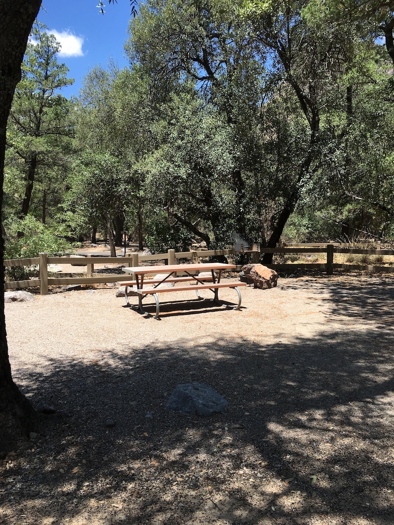
Camping in Chiricahua National Monument
Camping is available at Bonita Canyon Campground in Chiricahua National Monument. The campground is open year-round. Reservations are recommended. There are 25 sites without hook-ups and vehicles should not exceed 29 feet in length. There are no showers at Bonita Canyon Campground, but potable water and flush toilets are available. The nightly camping fee is $20.
How to Get to Chiricahua
The address for Chiricahua is 12856 E. Rhyolite Creek Rd. It is located about 120 miles east of Tucson, using Arizona Highway 186. Due to curvy roads, vehicles beyond 25 feet are prohibited beyond the Visitor Center, but vehicles up to 29 feet can camp in the campground. Chiricahua National Monument is open 24 hours a day and 365 days a year. It is a free NPS site to enter.
Articles Related to Explore Arizona’s Largest Sky Island at Chiricahua
Visit Chiricahua National Monument
Chiricahua National Monument has hiking, camping, and plenty of other things to see and do. Let Wander With Wonder be your guide when planning a visit to this monument, another National Park, or anywhere in the Southwest.
.
